At 581,730 km2 (224,607 sq mi) Botswana is the world's
48th-largest country. It is comparable in size to Madagascar, and is slightly smaller than the U.S.
state of Texas and the Canadian province
of Manitoba. It lies between
latitudes 17° and 27°S, and longitudes 20° and 30°E.
The country is predominantly flat, tending toward gently rolling tableland. Botswana is dominated by the
Kalahari Desert,
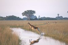
which covers up to 70% of its land surface. The Okavango Delta, one of the world's largest
inland deltas, is in the northwest. The Makgadikgadi Pan, a
large salt
pan, lies in the north.
The Limpopo River
Basin, the major landform of all of southern Africa, lies partly in Botswana,
with the basins of its tributaries, the Notwane, Bonwapitse,
Mahalapswe,
Lotsane, Motloutse and the Shashe, located in the
eastern part of the country. The Notwane provides water to the capital through
the Gaborone Dam. The Chobe River lies to the
north, providing a boundary between Botswana and Namibia's Zambezi Region. The Chobe
River meets with the Zambezi River at
a place called Kazungula (meaning a small sausage tree, a point where
Sebitwane and
his Makololo tribe
crossed the Zambezi into Zambia).
