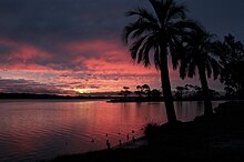
A dense fluvial network covers the country, consisting of four river basins, or deltas: the Río de la Plata, the Uruguay River, the Laguna Merín and the Río Negro. The major internal river is the Río Negro ('Black River'). Several lagoons are found along the Atlantic coast.
The highest point in the country is the Cerro Catedral whose peak reaches 514 metres (1,686 ft) AMSL in the Sierra Carapé hill range. To the southwest is the Río de Plata, the estuary of the Uruguay River which forms the western border, and the Paraná River.
Montevideo is the southernmost capital city in the Americas, and the third most southerly in the world (only Canberra and Wellington are further south).
There are ten national parks in Uruguay: Five in the wetland areas of the east, three in the central hill country, and one in the west along the Rio Uruguay.
Flora
Climate
Main article: Climate of
Uruguay
Located entirely within a temperate zone, Uruguay has a climate that is
relatively mild and fairly uniform nationwide. Seasonal
variations are pronounced, but extremes in temperature are rare. As would be
expected with its abundance of water, high humidity and fog are common. The absence
of mountains, which act as weather barriers, makes all locations vulnerable to
high winds and rapid changes in weather as fronts or storms sweep across the
country. Both summer
and winter weather may vary from day to day with the passing of storm fronts,
where a hot northerly wind may occasionally be followed by a cold wind (pampero)
from the Argentine Pampas.Uruguay has a largely uniform temperature throughout the year, with summers being tempered by winds off the Atlantic; severe cold in winter is unknown. The heaviest precipitation occurs during the autumn months, although more frequent rainy spells occur in winter. The mean annual precipitation is generally greater than 40 inches (100 cm), decreasing with distance from the sea coast, and is relatively evenly distributed throughout the year.
The average temperature for the midwinter month of July varies from 12 °C (54 °F) at Salto in the northern interior to 9 °C (48 °F) at Montevideo in the south. The midsummer month of January varies from a warm average of 26 °C (79 °F) at Salto to 22 °C (72 °F) at Montevideo. National extreme temperatures at sea level are, Paysandú city 44 °C (111 °F) (20 January 1943) and Melo city −11 °C (12 °F) (14 June 1967).

